

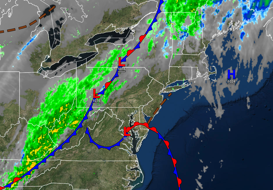
A cold front this afternoon will signal a shift in the weather pattern that will eventually support warmer, more seasonable weather conditions by next week.
TODAY
A cold front will approach the region with increasing clouds throughout the day. Winds will be from the southeast at 5 to 15 mph. Temperatures will rise into the upper 50s to mid-60s along the coast, lower to mid-60s over the interior, and mid-60s to lower 70s in the Delaware River Valley for highs.
TONIGHT
The cold front will move through the region with scattered to widespread showers and a few isolated thunderstorms from 4 PM to 10 PM from west to east. The thunderstorms will be capable of heavy downpours, occasional lightning, and wind gusts up to 40 mph. The skies will clear after midnight. Winds will veer to the northwest at 5 to 15 mph. Temperatures will fall into the mid-30s to lower 40s over the interior and mid to upper 40s along the coast for lows.
TOMORROW
As an area of low pressure intensifies in the Gulf of Maine, scattered to broken cloud cover and isolated showers can be expected, especially along the coast. Winds will be from the northwest at 10 to 20 mph with gusts up to 30 mph. Temperatures will rise into the mid to upper 40s over the interior and lower to mid-50s along the coast for highs.
THURSDAY AND FRIDAY
An area of low pressure off the coast will produce scattered cloud cover to overcast cloud cover with isolated showers. Winds will be from the northwest at 10 to 20 mph. Temperatures on Thursday will range from the lower to mid-30s over the interior and upper 30s to lower 40s along the coast for lows and mid to upper 40s over the interior and lower to mid-50s along the coast for highs. Temperatures on Friday will range from the lower to mid-30s over the interior and upper 30s to lower 40s along the coast for lows and lower to mid-50s over the interior and upper 50s to lower 60s along the coast for highs.
SATURDAY
High pressure will attempt to build south into the region with scattered cloud cover. An isolated shower will remain a threat. Temperatures will range from the lower to mid-30s over the interior and upper 30s to lower 40s along the coast for lows and mid to upper 50s over the interior and lower to mid-60s along the coast for highs.
SUNDAY
High pressure will exit the region with the scattered cloud cover expected. An isolated shower remains a threat to the region, especially along the coast. Temperatures will range from lower to mid-30s over the interior and upper 30s to lower 40s along the coast for lows and lower to mid-60s over the interior, mid to upper 60s along the coast, and upper 60s to lower 70s in the Delaware River Valley for highs.
MONDAY
A warm front will approach the region with increasing clouds throughout the day followed by scattered showers in the evening. Temperatures will range from the mid to upper 40s over the interior and upper 40s to lower 50s along the coast for lows and lower to mid-60s along the coast, mid to upper 60s over the interior, and upper 60s to lower 70s in the Delaware River Valley for highs.
TUESDAY
A cold front will follow with scattered showers in the afternoon and evening. Temperatures will range from the lower to mid-50s for lows and mid-60s to lower 70s on the coast, upper 60s to lower 70s over the interior, and mid to upper 70s in the Delaware River Valley for highs.


