

An active weather pattern continues today through this weekend, but pleasant and warmer weather is around the corner.
TODAY
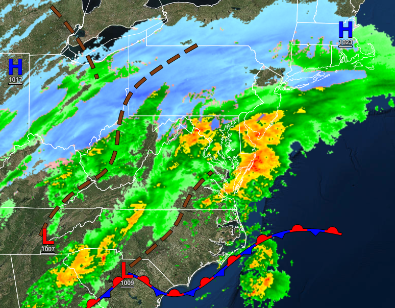
An area of low pressure will produce a wintry mix of snow, sleet, and rain over the interior and a mix of snow and rain along the coast throughout the day. The snow accumulation will be heavily dependent on elevation and surface type. Given the surface temperatures, many treated roadways will likely remain wet. Winds will veer to the east at 5 to 15 mph. Temperatures will rise into the lower to mid-30s over the interior and mid-30s to lower 40s along the coast for highs.

TONIGHT
Skies will clear as the low-pressure system departs and high pressure builds into the region. Winds will be from the north at 5 to 15 mph. Temperatures will fall into the mid to upper 20s over the interior and upper 20s to lower 30s along the coast for lows.
TOMORROW
High pressure will be in control with clear skies to scattered cloud cover with light and variable winds. Temperatures will rise into the lower to mid-40s over the interior and upper 40s to lower 50s along the coast for highs.
FRIDAY
High pressure will produce clear skies to scattered cloud cover. Winds will be from the southeast at 5 to 15 mph. Temperatures will range from the lower to mid-20s over the interior and upper 20s to lower 30s along the coast for lows and lower to mid-50s over the interior and along the coast and mid-50s to lower 60s in the Delaware River Valley for highs.
SATURDAY
A strong area of low pressure will produce periods of rain, heavy at times, mixing over to snow before ending. Some snow accumulation is likely, especially for the higher elevations. Temperatures will range from the mid-20s to lower 30s over the interior and mid-30s to lower 40s along the coast for lows and lower to mid-30s over the interior and upper 30s to lower 50s along the coast for highs. Temperatures are expected to peak in the morning hours and then fall throughout the afternoon.
SUNDAY THROUGH WEDNESDAY
High pressure will produce clear skies to scattered cloud cover. Temperatures on Sunday will range from the mid-10s to lower 20s for lows and mid to upper 30s for highs. Temperatures on Monday will range from the mid to upper 20s over the interior and lower to mid-30s along the coast for lows and upper 40s to mid-50s for highs. Temperatures on Tuesday will range from the mid to upper 30s over the interior the lower to mid-40s along the coast for lows and upper 40s to lower 50s over the interior and mid-50s to lower 60s along the coast for highs. Temperatures on Wednesday will range from the upper 20s to lower 30s over the interior and lower to mid-30s along the coast for lows and mid to upper 50s over the interior, lower to mid-50s along the coast, and upper 50s to mid-60s in the Delaware River Valley for highs.


