

 A cold front will clear the coast with more chilly conditions on the way. Unsettled conditions will return for the weekend into next week as an active pattern takes hold.
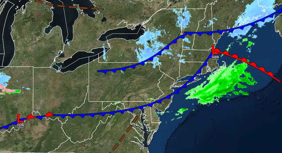
TODAY
A few showers will linger this morning as a cold front clears the coast. Skies will clear by this afternoon. Winds will be from the northwest at 5 to 15 mph. Temperatures will rise into the lower to mid-30s for higher elevations, upper 30s to lower 40s for the New York City metropolitan area, and mid to upper 40s for the Philadelphia metropolitan area for highs.
TOMORROW
High pressure will produce clear skies throughout the region. Winds will be light and variable. Temperatures will range from the lower 10s over the interior to the lower 20s along the coast for lows and mid to upper 30s for highs.
SATURDAY
A warm front will lift through the region with increasing clouds through the day followed by showers in the evening hours. Winds will be from the southeast at 5 to 15 mph. Temperatures will range from the lower to mid-20s for lows and mid to upper 40s over the interior and New York City metropolitan area and lower to mid-50s in the Philadelphia metropolitan areas for highs.
SUNDAY
A cold front will follow with periods of showers throughout the day, heavy at times. Temperatures will range from the lower to mid-40s over the interior and mid to upper 40s along the coast for lows and upper 50s to lower 60s along the coast, mid-60s to lower 70s away from the coast for highs.
MONDAY AND TUESDAY
A cold front with waves of low pressure will linger over the region with periods of rain throughout much of the region along with a wintry mix of snow, sleet, and rain for higher elevations. A large range of temperatures can be expected throughout the period. Temperatures on Monday will range from the mid-30s in the Poconos to the upper 40s to lower 50s along the coast for lows and mid to upper 50s over the interior to the lower 70s in the southern Delaware River Valley for highs. Temperatures on Tuesday will range from the lower 30s in the Poconos and Catskills to the upper 40s in the southern Delaware River Valley for lows and the upper 30s over the interior to the mid-50s in the southern Delaware River Valley for highs.
WEDNESDAY
High pressure will build into the region with clear skies to scattered cloud cover. Temperatures will range from the lower to mid-20s over the interior to the upper 20s to lower 30s along the coast for lows and mid-40s to lower 50s for highs.
THURSDAY
An area of low pressure will approach the region with periods of rain in the afternoon and evening. Temperatures will range from the lower to mid-30s over the interior and mid to upper 30s along the coast for lows and upper 30s to lower 40s over the interior to the lower to mid-40s along the coast for highs.


