

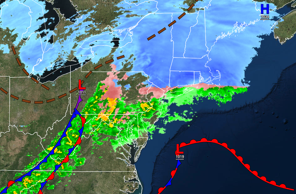
An icy wintry mix this morning will gradually change over to rain before ending in the early afternoon. Tranquil conditions return for the weekend.
TODAY
The low-pressure system will exit with rain and snow ending from noon to 3 PM from west to east. Skies will clear towards evening. Winds will be from the northwest at 5 to 15 mph. Temperatures will rise into the upper 30s to lower 40s over the interior, lower to mid-40s in the New York City metropolitan area, and upper 40s to lower 50s in the Philadelphia metropolitan area.
TOMORROW
High pressure will build into the region with clear skies to scattered clouds. Winds will be from the northwest at 5 to 15 mph. Temperatures will range from the lower 10s over the interior to the lower to mid-20s along the coast for lows and lower to mid-30s over the interior and mid-30s to lower 40s along the coast for highs.
SUNDAY
High pressure will be in control with clear skies to scattered cloud cover. Winds will be from the west at 10 to 20 mph. Temperatures will range from the lower 20s over the interior to the upper 20s along the coast for lows and lower 40s over the interior to the upper 40s along the coast for highs.
MONDAY THROUGH WEDNESDAY
High pressure will shift off the coast with scattered clouds to clear skies. Temperatures on Monday will range from the single digits over the interior to the lower 20s along the coast for lows and upper 20s to mid-30s for highs. Temperatures on Tuesday will range from the lower 20s over the interior to the lower 30s along the coast for lows and mid-40s over the interior to the mid-50s along the coast for highs. Temperatures on Wednesday will range from the upper 20s over the interior to the mid-30s along the coast for lows and upper 40s to mid-50s over the interior, upper 40s to lower 50s along the coast, and mid-50s to lower 60s in the Delaware River Valley for highs.
THURSDAY
A weak trough will pass through the region with flurries and snow showers in the morning followed by scattered clouds. Temperatures will range from the upper 10s over the interior to the lower 30s along the coast for lows and lower 30s over the interior to the mid-40s along the coast for highs.
FRIDAY
High pressure will produce clear skies to scattered clouds. Temperatures will range from the lower 10s over the interior to the lower 20s along the coast for lows and upper 30s over the interior to the lower to mid-40s along the coast for highs.


