

Warm conditions, fog, and showers today will give way to crash temperatures and a wintry mix by tomorrow morning. A tranquil weather pattern returns for next week.
TODAY
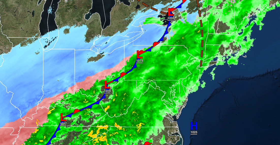
A strong cold front will approach with locally dense fog in the morning hours giving way to overcast skies and periods of showers through the afternoon and evening. Steady rain is expected at night. Winds will be from the south at 5 to 15 mph. Temperatures will rise into the lower to mid-40s over the interior and upper 40s to lower 50s along the coast for highs.
TOMORROW
An arctic cold front with waves of low pressure will slowly move through the region with periods of rain mixing over to sleet and snow from northwest to southeast throughout the day. Snow and ice accumulation will be likely north and northwest of the I-95 corridor, especially for higher elevations. Slick roadways and poor visibility are expected. Winds will veer from the south to the northwest at 5 to 15 mph with gusts up to 20 mph at times. Temperatures will fall through the 50s and 40s into the 20s throughout the day into the evening hours.

SATURDAY AND SUNDAY
High pressure will be in control with clear skies to scattered cloud cover. Winds will veer from the northwest to the east at 5 to 15 mph. Temperatures on Saturday will range from the lower 10s over the interior to the lower 20s along the coast for lows and mid-10s over the interior to the mid-20s along the coast for highs. Temperatures on Sunday will range from the negative single digits over the interior to the mid-10s along the coast for lows and mid to upper 20s for highs.
MONDAY THROUGH THURSDAY
High pressure will produce clear skies to scattered clouds. Temperatures on Monday will range from the mid-10s to lower 20s over the interior and mid-20s to lower 30s along the coast for lows and mid-30s over the interior and upper 30s along the coast for highs. Temperatures on Tuesday will range from the single digits to mid-10s over the interior and upper 10s to mid-20s along the coast for lows and mid-30s over the interior and upper 30s to lower 40s along the coast for highs. Temperatures on Wednesday will range from the single digits to mid-10s over the interior upper 10s to mid-20s along the coast for lows and lower to mid-40s over the interior and New York City metropolitan area and mid to upper 40s in the Philadelphia metropolitan area and southern New Jersey for highs. Temperatures on Thursday will range from the lower to mid-20s over the interior and upper 20s to lower 30s along the coast for lows and lower to mid-40s over the interior and mid-40s to lower 50s along the coast for highs.


