

Cold weather conditions return to the region and remain in place through the end of the week. A significant winter storm is becoming likely for Friday night into Saturday.
TODAY
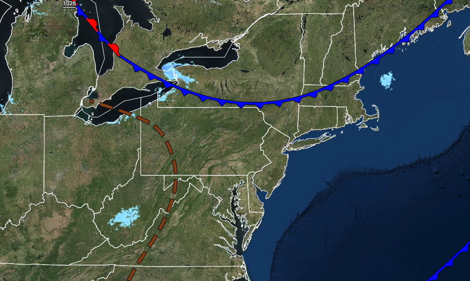
A cold front will pass through the region with scattered cloud cover. Winds will be from the northwest at 5 to 15 mph. Temperatures will rise into the mid to upper 10s over the interior and lower to mid-20s along the coast for highs.
TONIGHT
High pressure will build into the region with clearing skies. Winds will be from the northwest at 5 to 15 mph. Temperatures will fall into the single digits below zero over the interior to the mid-10s along the coast for lows.
TOMORROW
High pressure will produce clear skies to scattered cloud cover. Winds will back to the southwest at 5 to 15 mph. Temperatures will rise into the lower to mid-20s over the interior and mid to upper 20s along the coast for highs.
FRIDAY
An arctic cold front will approach from the west while an area of low pressure will organize over the coastal waters which will produce scattered snow showers in the afternoon and evening hours. Winds will veer from the southwest to the northwest at 5 to 15 mph. Temperatures will range from the upper 10s to the lower 20s over the interior and mid to upper 20s along the coast for lows and upper 20s to lower 30s over the interior and lower to mid-30s along the coast for highs.
SATURDAY
An area of low pressure will intensify well east of the coastal water with periods of snow on the coast and snow showers over the interior. There is an increasing threat for significant snowfall, especially for the immediate coast. A shift in the storm track to the west or east would have a significant impact on the outcome of the storm. Windy conditions can be expected along with coastal flooding threats. Temperatures will range from the single digits over the interior to the upper 10s along the coast for lows and mid-10s over the interior to the mid-20s along the coast for highs.
SUNDAY THROUGH WEDNESDAY
High pressure will be in control with clear skies to scattered cloud cover. Temperatures on Sunday will range from the single digits over the interior to the mid-10s along the coast for lows and mid-10s over the interior to the mid-20s along the coast for highs. Temperatures on Monday will range from the single digits below zero to single digits above zero for lows and lower to mid-20s for highs. Temperatures on Tuesday will range from the single digits to lower 10s for lows and upper 20s to lower 30s for highs. Temperatures on Wednesday will range from the upper 20s to lower 30s over the interior and mid to upper 30s along the coast for lows and mid to upper 40s over the interior and upper 40s to lower 50s along the coast for highs.


