

After the impressive snowfall leaves this morning, clearing skies can be expected by late morning with chilly conditions. An arctic blast is expected by next week.
TODAY
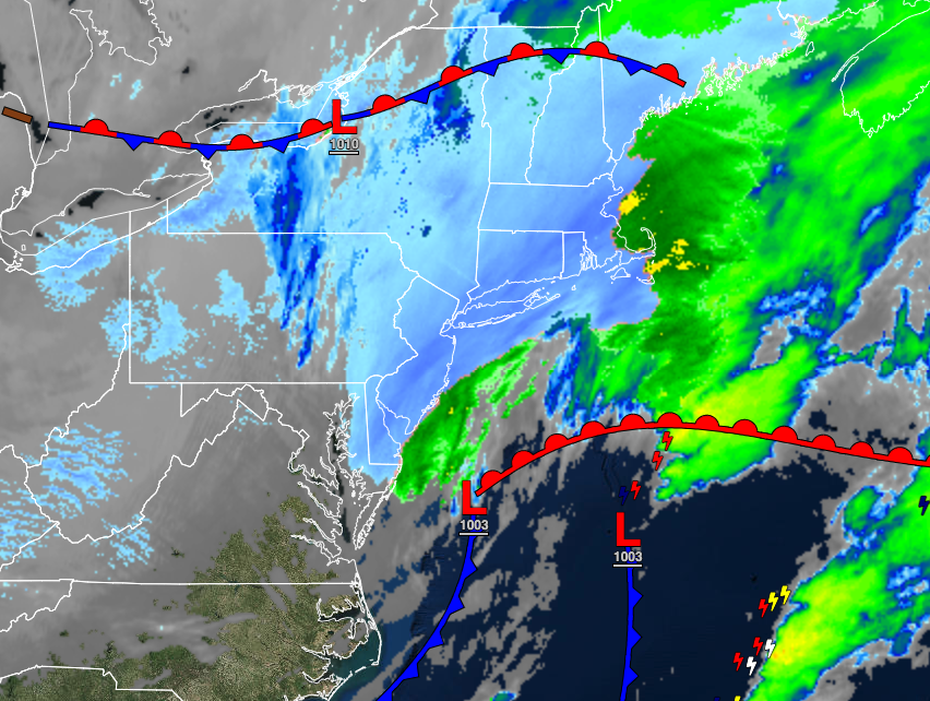
An area of low pressure will exit off the Mid Atlantic coast with periods of snow, heavy at times along the coast through 10 AM. After the snow exits, skies will clear with high-pressure building into the region. Winds will be from the northwest at 5 to 15 mph. Temperatures will rise into the upper 20s over the interior and lower to mid-30s along the coast for highs.
TOMORROW
Scattered clouds to clear skies are expected. Winds will be from the northwest at 5 to 15 mph. Temperatures will range from the single digits to mid-10s over the interior and upper 10s to lower 20s along the coast for lows and lower to mid-20s over the interior and upper 20s to lower 30s along the coast for highs.
SUNDAY
A cold front will pass through the region with scattered rain and snow showers. Winds will be from the southwest at 5 to 15 mph. Temperatures will range from the mid to upper 10s over the interior and lower to mid-20s along the coast for lows and mid to upper 30s over the interior and upper 30s to lower 40s along the coast for highs.
MONDAY
Scattered clouds with flurries and a few lake-effect snow showers, especially in the Poconos and Catskills, can be expected. Temperatures will range from the upper 10s to mid-20s over the interior and upper 20s to lower 30s along the coast for lows and mid-20s to lower 30s over the interior and mid to upper 30s along the coast for highs.
TUESDAY AND WEDNESDAY
High pressure will produce clear but cold weather conditions. Temperatures on Tuesday will range from the lower to mid-10s over the interior and upper 10s to lower 20s along the coast for lows and mid to upper 10s over the interior and lower to mid-20s along the coast for highs. Temperatures on Wednesday will range from the single digits to mid-10s for lows and lower to mid-20s for highs.
THURSDAY AND FRIDAY
A series of weak troughs will pass through the region with a few isolated rain and snow showers. Otherwise, scattered clouds are expected. Temperatures on Thursday will range from the mid to upper 10s over the interior and lower to mid-20s along the coast for lows and mid to upper 30s over the interior and upper 30s to mid-40s along the coast for highs. Temperatures on Friday will range from the lower to mid-20s over the interior and mid to upper 20s along the coast for lows and mid to upper 30s over the interior and lower to mid-40s for highs.


