

 Snow will be on the way for the whole Northern Mid Atlantic, but the focus once again will be along the coast with the potential for a heavy burst of snow.
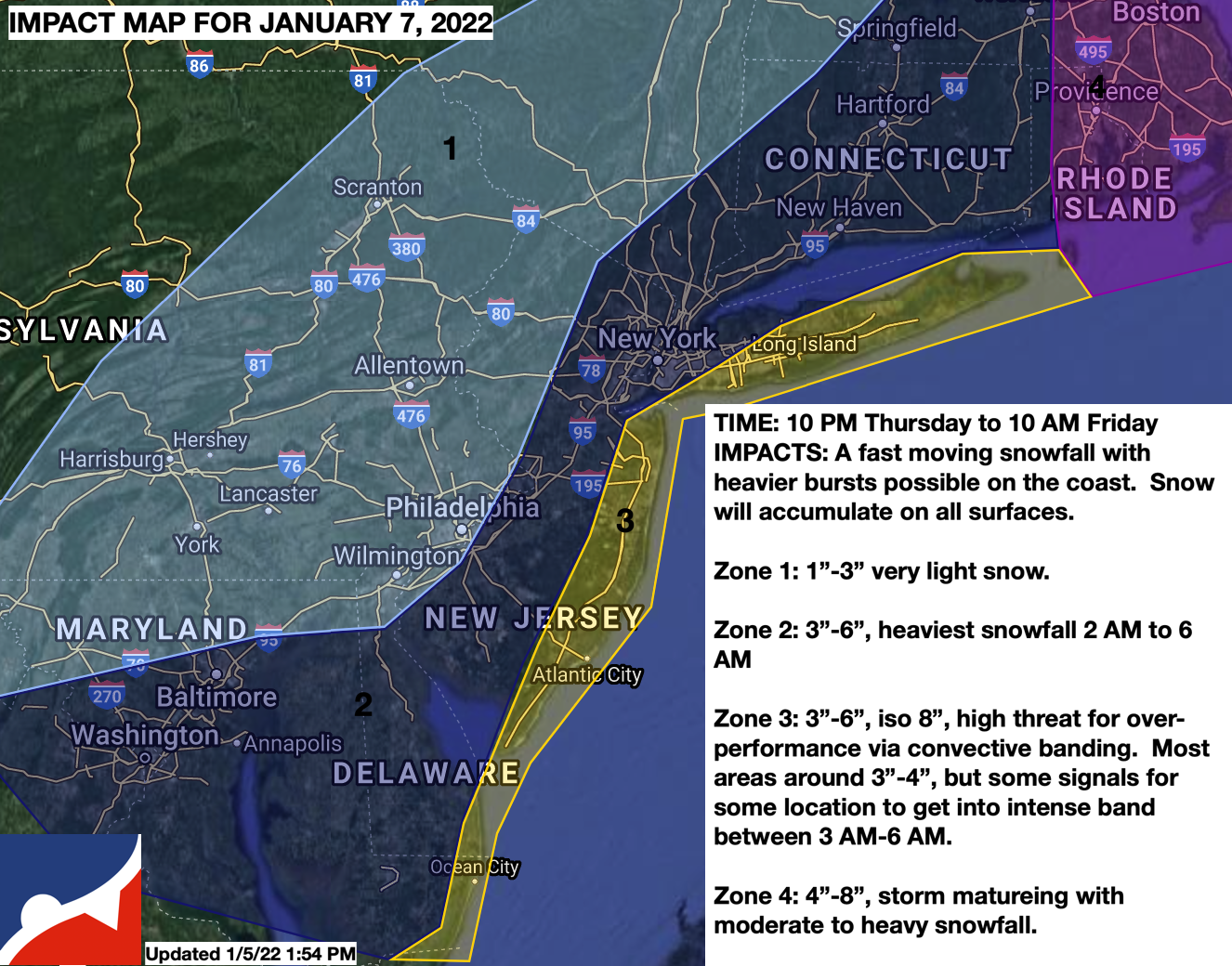
TOMORROW NIGHT
Clouds will increase with snow showers breaking out after 10 PM and becoming widespread by 2 AM throughout the entire region. The snow will be light but accumulate at the start. Winds will be from the north at 5 to 10 mph. Temperatures will be falling through the mid-30s into the upper 20s.
FRIDAY MORNING
The low-pressure system will rapidly move through the New Jersey coastal waters while intensifying. Light to moderate snow can be expected from 2 AM through 8 AM with steady snow accumulation. Moderate snow bands will be focused to the east of the Delaware River through Connecticut. There is potential for intense snowfall in zone 3 (yellow) via mesoscale banding. While most locations will be around 3″ to 4″ of snow, there is a threat from 3 AM to 7 AM for heavy snowfall with snowfall rates over 1″ per hour. This threat is low but present. Winds will be from the northwest at 5 to 15 mph. Temperatures will be in the mid to upper 20s. Snowfall will come to an end from west to east from 6 AM to 10 AM.


