

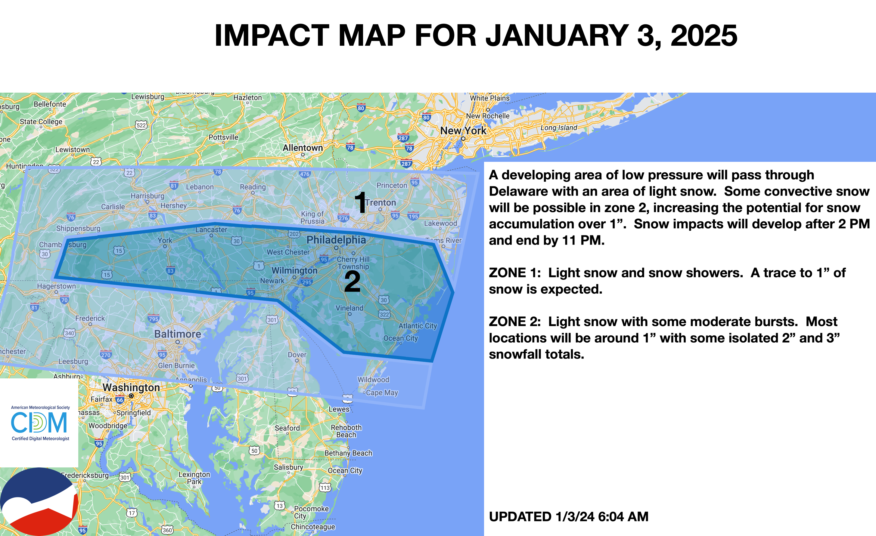

A strong cold front with an area of light snow showers moved through the region. A mid-level shortwave enhanced the snowfall over southeastern Pennsylvania and southern New Jersey to produce a dusting to 1″ of snow in these locations. Only a few flurries were reported for the rest of the region. Snowfall in the Poconos and Catskills was caused by Lake Effect Snow bands.
FORECAST: 60%
The shortwave was expected to produce a moderate band of snowfall. While this band did occur, the snowfall did not last long enough to support snowfall totals over 1″ in southeastern Pennsylvania and southern New Jersey.
Please follow and like us:


