

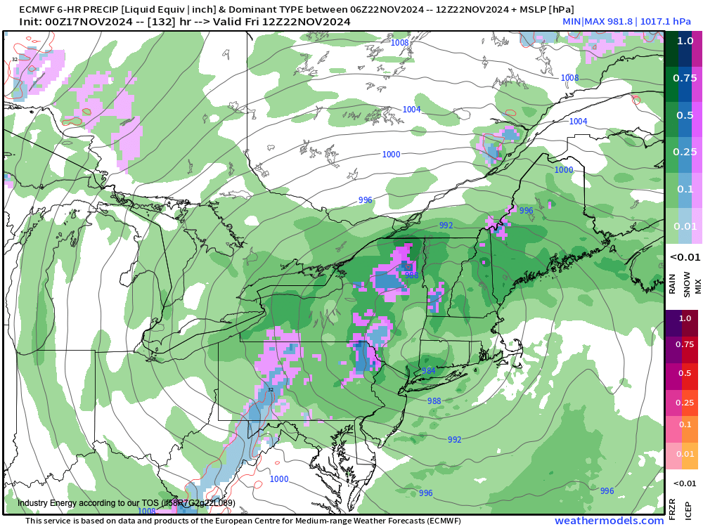
 At the end of this upcoming week, a strong cold front will drive through the region as a powerful upper-level low-pressure system will move into New England on Thursday through Friday. With the upper-level low-pressure system centered over New England and a surface low-pressure system becoming vertically stacked, a Polar air mass will invade the entire Mid-Atlantic and New England. At 850 MB, temperatures on Friday morning will fall into a range of 0°C to -3°C. However, 925 MB temperatures will range from 0°C to 2°C. This tells me that while snow will be possible in the Poconos and Catskills. However, this snow will be mostly found above 2,000 feet and only accumulate on cold surfaces and vegetation. The snow will be of a very wet variety and likely melt away quickly by the afternoon hours as temperatures rebound into the 40s. However, the first snowfall of the season for our highest-elevations will be possible.


Whether you are a weather enthusiast or an owner of a business; you can trust in the unique weather consultation provided only by NY NJ PA Weather!