

Various models suggest a rapid increase of activity in the Tropical Atlantic over the next 10 to 15 days. We can’t provide details at this point, and I wouldn’t be a very good meteorologist if I tried because warm-core low-pressure systems are pretty fickle. However, we can see the reason for the shift in the model guidance over the past 24 hours.
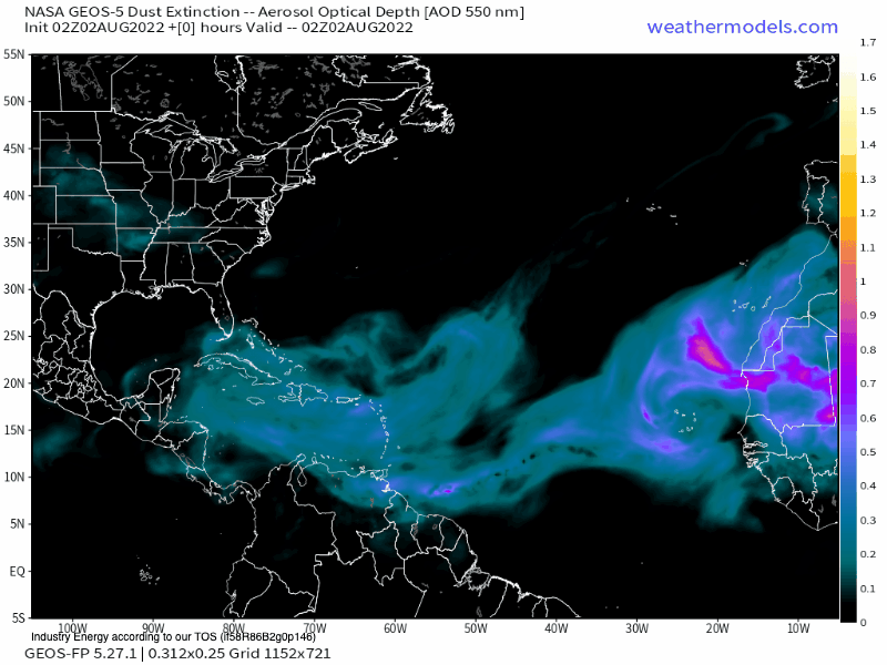
The NASA GEOS-5 Dust model through August 12th shows that the influence of the Sahara dust is subsiding. The Tropical Atlantic is expected to reduce this dry layer significantly by the middle of the month. Typically, we can see a rapid expansion of tropical development after August 15th. The reality is that while the Tropical Atlantic has been quiet, typically, the 4th named storm doesn’t happen until around August 15th, so we aren’t too far away from going above normal for the season.
Expect the wave of Sahara dust to reduce intensity over the next several weeks, and tropical activity will begin to grow. Enjoy the quiet period while you can.


