

 The weather pattern for the first week of August will be very similar to the last 15 days of July, with generally dry conditions and above-normal temperatures. While thunderstorms will be a threat, there will be far too many limiting factors to support widespread rainfall and improve the drought conditions that are starting to take hold.
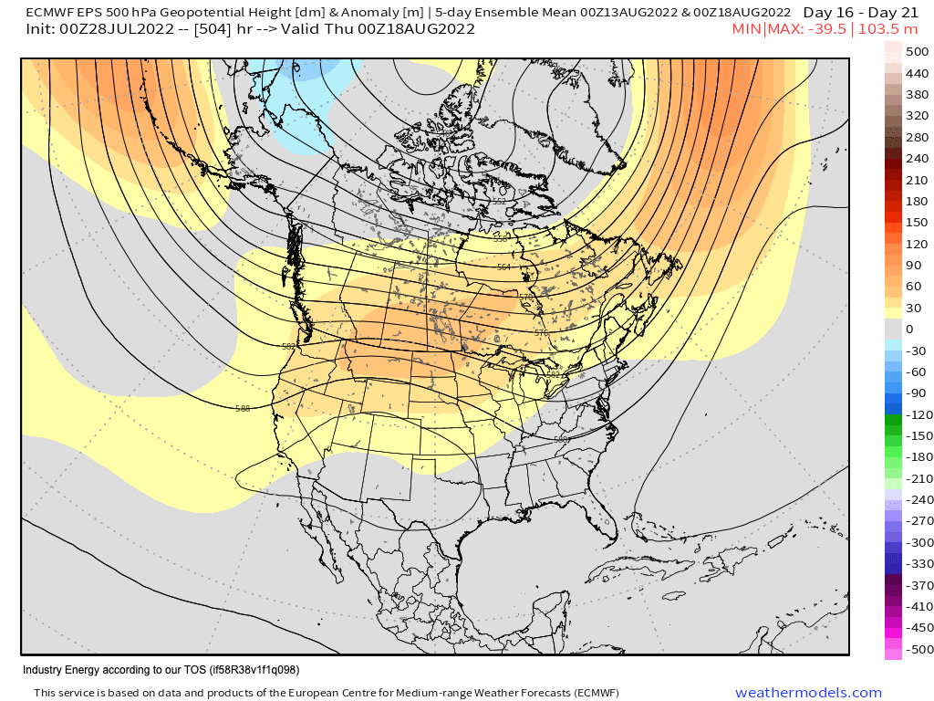
However, by the second week of August, an important change will start to take place. In the middle of August, the weather pattern will start to feel the shift of the seasons from Summer to Fall, and with that, the Polar jet stream will start to become slightly stronger. There is strong support from various models that the EPO will start to remain negative more often. As a result, we’ll observe a trough around the Aleutian Islands and another trough around Eastern North America. This signal will support stronger Polar air masses invading New England and Mid Atlantic, which will mean stronger cold fronts will be more viable. In terms of temperatures, we’ll see stronger support for hot and humid air masses being cut short faster and temperatures trending from above normal to near normal. However, I am less confident about the trend of near to above normal rainfall through this period if only cold fronts drive this weather pattern shift. However, IF there is an increase in tropical activity and thus remnants of rainfall from these tropical low-pressure systems, the region will rapidly go from below normal to above normal in a very short period.
The second half of August will feature a western Atlantic ridge along the East coast and a trough axis between the Tennessee River Valley and the East coast, which means if a tropical low-pressure system reaches the Bahamas, then the remnants or even the actual tropical low-pressure could be a threat for the region and fundamentally alter the nature of this month’s anomalies.


