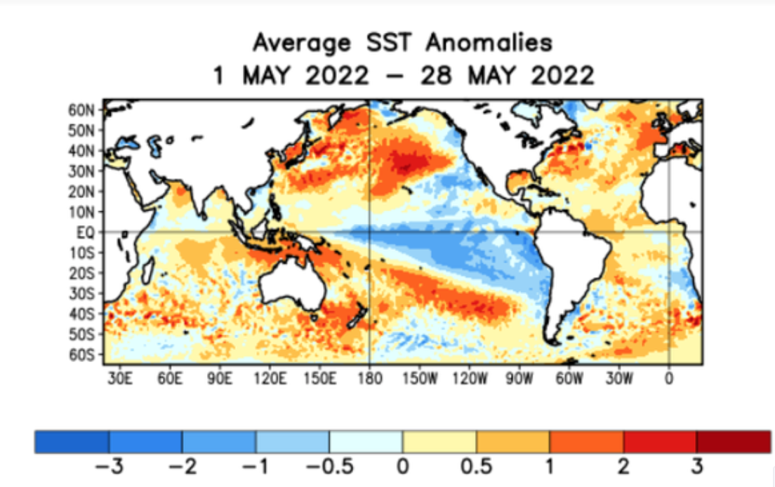
Model data of late has been strongly hinting at a weakening La Nina for the rest of the Summer with a cold-neutral status by the Fall and Winter. While I think the progression and weakening of La Nina is too fast on the model data, I do see some hints in the observations for the gradual weakening.
First, we must understand what caused this third wave of La Nina conditions. The very warm anomalies in the Indian Ocean in March and April produced enough force to enhance the atmospheric circulation for another La Nina to develop. This third wave was not expected by me and the development is extremely rare. Now, this forcing mechanism is coming to an end as the Indian Ocean cools, which means the support for a sustained positive SOI state is coming to an end. In fact, today is the first day in over two months that we have a weak negative daily contribution to the SOI state.
With some observations pointing towards a weakening La Nina, the question is not if La Nina will weaken but simply how fast. The model guidance tends to illustrate this progression a bit too fast, but I do like the idea of a cold-neutral state by the middle of Fall. However, changes to the atmospheric state will likely linger into November. As such, I don’t see this process having any influence on the weather pattern for the Summer and little if any impact on the Atlantic Hurricane Season, although the MJO will start to gain more influence on time periods of potential.
In terms of the Winter, there are too many unknowns to provide details, however, I do like the idea of a winter with tropical forcing more from the MJO rather than an ENSO state.


