
UPDATED 08/27/26 7:14 AM
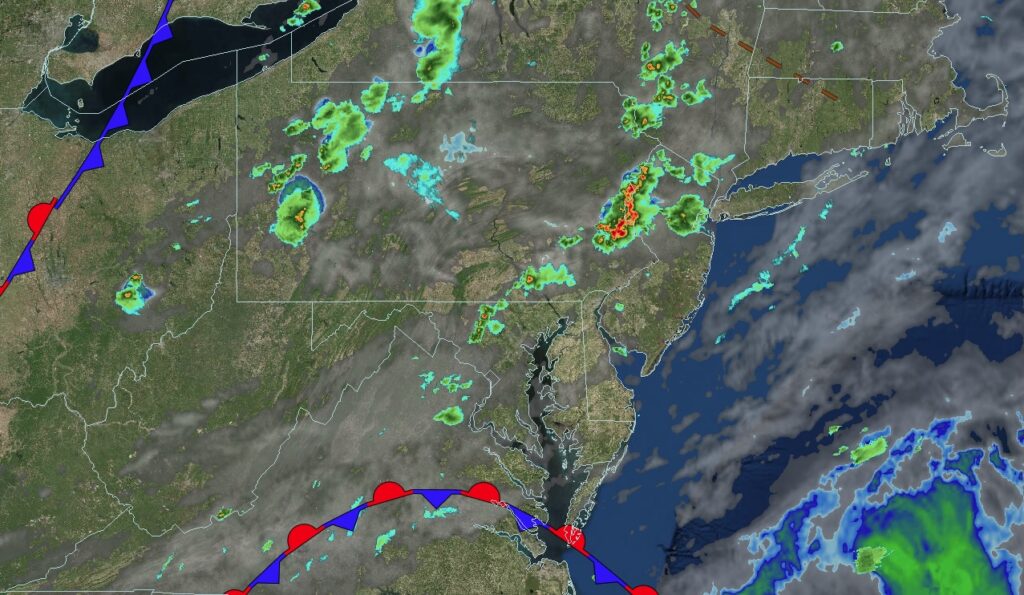
Waves of showers and thunderstorms are expected today with the potential for flash flooding and a few severe thunderstorms producing powerful wind gusts and hail.
TODAY
A cold front will produce scattered showers and thunderstorms. A few thunderstorms may reach severe levels with intense downpours, frequent lightning, hail, and wind gusts between 40 and 65 mph. Winds will be from the south at 5 to 10 mph. High temperatures will range from the mid-to-upper 70s over the interior and Long Island and the lower to mid-80s along the I-95 corridor.
TONIGHT
A cold front will move through the region, bringing lingering showers and thunderstorms. Winds will veer to the west at 5 to 10 mph. Low temperatures will range from the lower to mid-60s over the interior and upper 60s to lower 70s along the coast.
TOMORROW
A cold front will clear the region with scattered showers and isolated thunderstorms. Winds will become light and variable. High temperatures will range from the upper 70s to lower 80s over the interior and lower to mid-80s along the coast.
TOMORROW NIGHT
A trough will produce scattered clouds and isolated showers. Winds will be light and variable. Low temperatures will range from the upper 50s to the lower 60s over the interior, the mid to upper 60s in the suburbs, and the upper 60s to the lower 70s in urban areas.
SATURDAY
A trough will produce scattered clouds and isolated showers. Winds will be light and variable. High temperatures will range from the upper 70s to lower 80s over the interior, lower to mid-80s on Long Island, and mid-80s along the I-95 corridor.
SUNDAY
A trough will produce scattered clouds and isolated showers. Winds will be from the southwest at 5 to 10 mph. Low temperatures will range from the upper 50s to the lower 60s over the interior, the mid to upper 60s in the suburbs, and the upper 60s to the lower 70s in urban areas. High temperatures will range from the upper 70s to the lower 80s over the interior, the lower to mid-80s on Long Island, and the mid-80s along the I-95 corridor.
MONDAY
A trough will produce scattered clouds and isolated thunderstorms. Low temperatures will range from the mid-to-upper 60s over the interior and the lower to mid-70s along the coast. High temperatures will range from the lower to mid-80s on Long Island and upper 80s to lower 90s elsewhere.
TUESDAY
A trough will produce scattered clouds and isolated thunderstorms. Low temperatures will range from the mid-to-upper 60s over the interior and the lower to mid-70s along the coast. High temperatures will range from the lower to mid-80s on Long Island and the upper 80s to lower 90s elsewhere.
WEDNESDAY
A cold front will bring showers and thunderstorms, along with hot, humid conditions. Low temperatures will range from the lower to mid-70s inland and the mid to upper 70s along the coast. High temperatures will range from the upper 80s to lower 90s over the interior and lower to mid-90s along the coast. Expect a heat index near 100.
THURSDAY
A trough will produce scattered clouds and isolated showers. Low temperatures will range from the mid to upper 60s over the interior and suburbs and upper 60s to lower 70s in urban areas. High temperatures will range from the mid-to-upper 70s over the interior and Long Island and the upper 70s to lower 80s along the I-95 corridor.

