
UPDATED 08/21/26 8:55 AM
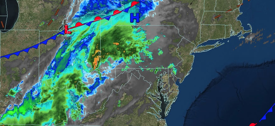
Clearing skies will continue to work to the east today, but an active weather pattern will continue with showers tomorrow and isolated thunderstorms on Sunday.
TODAY
A low-pressure area will depart the region, leaving lingering showers over eastern Long Island and eastern Connecticut this morning. Scattered clouds are expected elsewhere. Winds will be from the northeast at 5 mph. High temperatures will range from the mid to upper 70s over the interior and Long Island and upper 70s to lower 80s along the I-95 corridor.
TONIGHT
High pressure will depart the region with increasing clouds. An area of low pressure will produce showers by morning. Winds will be from the northeast at 5 mph. Low temperatures will range from the mid to upper 50s over the interior, lower to mid-60s in the suburbs, and mid to upper 60s in urban areas.
TOMORROW
A low-pressure area will produce periods of rain along the coast and scattered showers over the interior. Winds will veer to the south at 5 mph. High temperatures will range from the mid-to-upper 70s.
TOMORROW NIGHT
A trough will linger over the region with scattered clouds and isolated showers. Winds will be from the south at 5 mph. Low temperatures will range from the lower to mid-60s over the interior and mid to upper 60s along the coast.
SUNDAY
A cold front will produce scattered showers and isolated thunderstorms. Winds will be from the southwest at 5 mph. High temperatures will range from the mid to upper 70s over the interior and upper 70s to lower 80s along the coast.
MONDAY
A trough will produce variable clouds and isolated showers. Winds will be from the southwest at 5 to 10 mph. Low temperatures will range from the mid to upper 50s over the interior and lower to mid-60s along the coast. High temperatures will range from the lower to mid-70s over the interior, mid to upper 70s on Long Island, and upper 70s to lower 80s along the I-95 corridor.
TUESDAY
A trough will produce variable clouds and isolated showers. Low temperatures will range from the mid-to-upper 50s over the interior and the lower to mid-60s along the coast. High temperatures will range from the lower to mid-70s over the interior, mid to upper 70s on Long Island, and upper 70s to lower 80s along the I-95 corridor.
WEDNESDAY
A trough will produce variable clouds and isolated showers. Low temperatures will range from the mid-to-upper 50s over the interior and the lower to mid-60s along the coast. High temperatures will range from the lower to mid-70s over the interior, mid to upper 70s on Long Island, and upper 70s to lower 80s along the I-95 corridor.
THURSDAY
A cold front will produce scattered showers and isolated thunderstorms. Low temperatures will range from the upper 50s to the lower 60s over the interior and the mid-to-upper 60s along the coast. High temperatures will range from the mid-to-upper 70s over the interior and Long Island, and the lower to mid-80s along the I-95 corridor.
FRIDAY
A stalled front will produce scattered showers. Low temperatures will range from the mid-to-upper 60s over the interior and the upper 60s to lower 70s along the coast. High temperatures will range from the upper 70s to lower 80s on Long Island and lower to mid-80s elsewhere.


