


UPDATED 08/09/26 9:32 AM
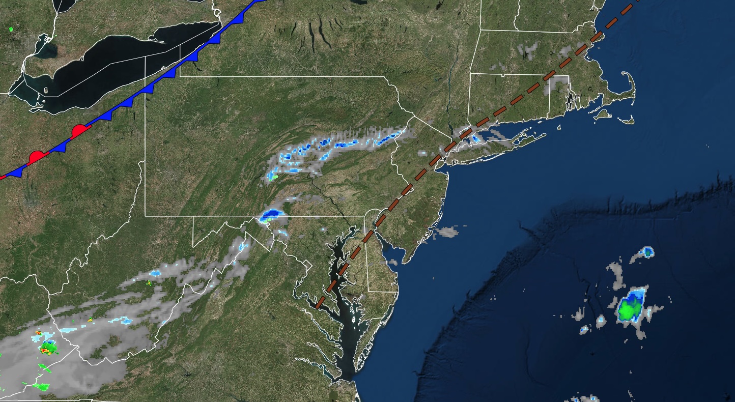
A quieter day is expected, with only an isolated threat of thunderstorms. However, muggy and stormy weather conditions will continue into next week.
TODAY
A stalled cold front will produce morning low clouds and afternoon isolated showers and thunderstorms. Winds will be from the southwest at 5 to 10 mph. High temperatures will range from the lower to mid-80s over the interior and Long Island, and from the upper 80s to the lower 90s elsewhere. A heat index in the mid-90s to the lower 100s is expected.
TONIGHT
A stalled cold front will produce morning low clouds and afternoon isolated showers and thunderstorms. Winds will be from the west at 5 to 10 mph. Low temperatures will range from the upper 60s to the lower 70s over the interior and from the lower to mid-70s along the coast.
TOMORROW
A stalled cold front will produce morning low clouds and afternoon widely scattered showers and thunderstorms. Winds will be from the west at 5 to 10 mph. High temperatures will range from the mid to upper 80s over the interior and Long Island, and from the lower to mid-90s elsewhere. A heat index in the mid-90s to the lower 100s is expected.
TOMORROW NIGHT
A cold front will produce scattered showers and thunderstorms. Winds will be from the west at 5 to 10 mph. Low temperatures will range from the upper 60s to the lower 70s over the interior and from the lower to mid-70s along the coast.
TUESDAY
A cold front will produce scattered showers and thunderstorms. Winds will be from the west at 5 to 10 mph. High temperatures will range from the upper 70s to the lower 80s at higher elevations, mid- to upper 80s over the interior and Long Island, and lower to mid-90s along the I-95 corridor.
WEDNESDAY
A cold front will stall over the region with scattered clouds and isolated showers and thunderstorms. Winds will be from the west at 5 to 10 mph. Low temperatures will range from the mid- to upper 60s over the interior to the lower to mid-70s along the coast. High temperatures will range from the lower to mid-80s.
THURSDAY
A stationary front will produce variable clouds and isolated showers and thunderstorms. Low temperatures will range from the lower to mid-60s over the interior and from the upper 60s to the lower 70s along the coast. High temperatures will range from the lower to mid-80s over the interior and mid to upper 80s along the coast.
FRIDAY
A stationary front will produce variable clouds and isolated showers and thunderstorms. Low temperatures will range from the upper 50s to lower 60s over the interior, mid to upper 60s in the suburbs, and upper 60s to lower 70s in urban areas. High temperatures will range from the lower to mid-80s over the interior and mid to upper 80s along the coast.
SATURDAY
A trough will produce scattered clouds and isolated showers. Low temperatures will range from the mid- to upper 50s over the interior, the lower to mid-60s in the suburbs, and the upper 60s to lower 70s in urban areas. High temperatures will range from the mid- to upper 70s over the interior and Long Island, the lower to mid-80s in the New York City metropolitan area, and the mid- to upper 80s in the Philadelphia metropolitan area.
SUNDAY
High pressure will produce scattered clouds. Low temperatures will range from the mid- to upper 50s over the interior to the lower to mid-60s along the coast. High temperatures will range from the upper 70s to the lower 80s on Long Island, the mid- to upper 80s along the I-95 corridor, and the lower to mid-80s over the interior.