


UPDATED 08/02/26 10:30 AM
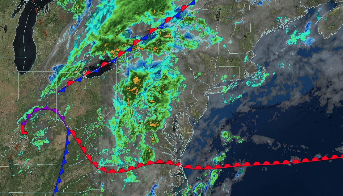
Clouds will increase, but showers will hold off today. Waves of showers and thunderstorms return late tonight through tomorrow.
TODAY
An approaching warm front will bring increasing cloud cover. Winds will be from the south at 5 to 10 mph. High temperatures will range from the upper 70s to lower 80s over the interior, mid to upper 70s on Long Island, lower to mid-80s in the New York City metropolitan area, and mid to upper 80s in the Philadelphia metropolitan area.
TONIGHT
A warm front will lift through the region with showers and thunderstorms, especially after midnight. Winds will be from the south at 5 to 10 mph. Low temperatures will range from the mid- to upper 60s over the interior to the lower to mid-70s along the coast.
TOMORROW
An area of low pressure and cold front will produce waves of showers and thunderstorms. The thunderstorms will produce intense downpours and frequent lightning. Winds will be from the south at 5 to 10 mph. High temperatures will range from the upper 70s to the lower 80s on Long Island and from the lower to mid-80s elsewhere.
TOMORROW NIGHT
The low-pressure system will depart with lingering showers through the evening, followed by clearing skies after midnight. Winds will be light and variable. Low temperatures will range from the upper 50s to the lower 60s over the interior and from the lower to mid-60s along the coast.
TUESDAY
High pressure will build into the region with clear skies. Winds will veer to the east at 1 to 5 mph. High temperatures will range from the upper 70s to the lower 80s over the interior and from the lower to mid-80s along the coast.
WEDNESDAY
A warm front and an area of low pressure will produce increasing cloud cover and isolated showers. Winds will be from the east at 1 to 5 mph. Low temperatures will range from the upper 50s to the lower 60s over the interior and from the lower to mid-60s along the coast. High temperatures will range from the upper 70s to the lower 80s on Long Island and from the lower to mid-80s elsewhere.
THURSDAY
A trough will produce variable clouds and isolated showers. Low temperatures will range from the mid to upper 60s over the interior and from the lower to mid-70s along the coast. High temperatures will range from the lower to mid-80s over the interior, New York City metropolitan area, and Long Island, and mid to upper 80s in the Philadelphia metropolitan area.
FRIDAY
A trough will produce variable clouds and isolated showers. Low temperatures will range from the mid to upper 60s over the interior and from the lower to mid-70s along the coast. High temperatures will range from the lower to mid-80s over the interior, New York City metropolitan area, and Long Island, and mid to upper 80s in the Philadelphia metropolitan area.
SATURDAY
A trough will produce variable clouds and isolated showers. Low temperatures will range from the mid to upper 60s over the interior and from the lower to mid-70s along the coast. High temperatures will range from the lower to mid-80s.
SUNDAY
A trough will produce variable clouds and isolated showers. Low temperatures will range from the mid to upper 60s over the interior and from the lower to mid-70s along the coast. High temperatures will range from the lower to mid-80s.