

UPDATED 06/23/26 10:07 AM
Cool and damp conditions today will give way to sunshine by tomorrow morning. An unsettled weather pattern continues into the weekend with periods of rain returning for the weekend.
TODAY
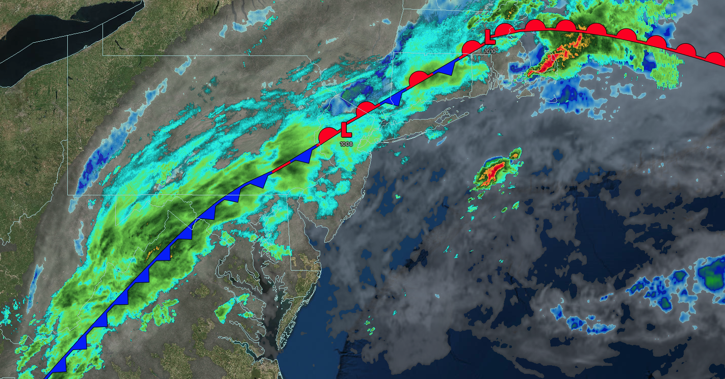
A cold front will slowly sink through the region with overcast skies and periods of showers. Winds will veer to the northwest at 5 to 15 mph. High temperatures will range from the lower to mid-70s.
TONIGHT
A cold front will push off the coast with gradually clearing skies. Winds will be from the northwest at 5 to 15 mph. Low temperatures will range from the lower to mid-50s over the interior, upper 50s to lower 60s in the suburbs, and lower to mid-60s in urban areas.
TOMORROW
High pressure will build into the region with scattered clouds. Winds will be from the northwest at 5 to 15 mph. High temperatures will range from the mid to upper 70s over the interior and upper 70s to lower 80s along the coast.
TOMORROW NIGHT
High pressure will produce scattered clouds. Winds will be light and variable. Low temperatures will range from the mid to upper 50s over the interior and upper 50s to lower 60s along the coast.
THURSDAY
A warm front will approach the region with increasing clouds, followed by scattered showers in the evening. Winds will veer to the south at 5 to 15 mph. High temperatures will range from the mid to upper 70s over the interior and Long Island and lower to mid-80s on the I-95 corridor.
FRIDAY
A cold front will produce scattered showers and thunderstorms in the morning. The cold front will stall along the coast with variable clouds and isolated showers. Winds will be from the southwest at 5 to 15 mph. Low temperatures will range from the lower to mid-60s over the interior and mid to upper 60s along the coast. High temperatures will range from the upper 70s to the lower 80s.
SATURDAY
An area of low pressure will produce periods of showers. Low temperatures will range from the lower to mid-60s over the interior and mid to upper 60s along the coast. High temperatures will range from the mid to upper 70s.
SUNDAY
A cold front will produce scattered clouds and isolated showers. Low temperatures will range from the upper 50s to the lower 60s over the interior and mid to upper 60s along the coast. High temperatures will range from the upper 70s to the lower 80s.
MONDAY
High pressure will produce scattered clouds. Low temperatures will range from the mid to upper 50s over the interior, lower to mid-60s in the suburbs, and mid to upper 60s in urban areas. High temperatures will range from the lower to mid-80s.
TUESDAY
An area of low pressure will produce periods of showers and thunderstorms. Low temperatures will range from the lower to mid-60s. High temperatures will range from the mid to upper 70s over the interior and Long Island and lower to mid-80s on the I-95 corridor.

