

UPDATED 05/03/26 10:25 AM
A cool and unsettled weather pattern will continue through this evening. Showers and thunderstorms become an increasing threat by the middle of next week.
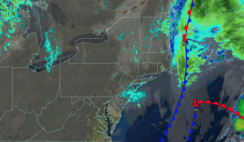
TODAY
An area of low pressure will produce periods of showers in the morning along the coast, followed by scattered clouds and isolated showers in the afternoon and evening. Winds will be from the northwest at 5 to 15 mph. High temperatures will range from the upper 40s to the lower 50s over the interior and from the mid to upper 50s along the coast.
TONIGHT
High pressure will produce scattered clouds. Winds will back to the southwest at 5 to 15 mph. Low temperatures will range from the upper 30s to lower 40s over the interior and lower to mid-40s along the coast.
TOMORROW
High pressure will produce scattered clouds. Winds will back to the southwest at 5 to 15 mph. High temperatures will range from the lower to mid-60s on Long Island, upper 60s to lower 70s in the New York City and Philadelphia metropolitan areas, and lower to mid-60s over the interior.
TOMORROW NIGHT
High pressure will exit the region with increasing clouds. Winds will be from the southwest at 10 to 20 mph. Low temperatures will range from the lower to mid-50s.
TUESDAY
High pressure will exit the region with increasing clouds. Winds will be from the southwest at 10 to 20 mph. High temperatures will range from the mid to upper 60s in southeastern Long Island, lower to mid-70s in northwestern Long Island, upper 70s to lower 80s in the Philadelphia and New York City metropolitan areas, and mid to upper 70s over the interior.
WEDNESDAY
A cold front will produce waves of showers and thunderstorms. Winds will be from the southwest at 5 to 15 mph. Low temperatures will range from the mid to upper 50s over the interior and suburbs and lower to mid-60s in urban areas. High temperatures will range from the lower to mid-60s in southeastern Long Island, upper 60s to lower 70s in northwestern Long Island, lower to mid-70s in the Philadelphia and New York City metropolitan area, and mid to upper 60s over the interior.
THURSDAY
An area of low pressure and a cold front will produce periods of showers and thunderstorms. Low temperatures will range from the mid to upper 40s in higher elevation, lower to mid-50s over the interior, mid to upper 50s in the suburbs, and upper 50s to lower 60s in urban areas. High temperatures will range from the mid to upper 40s in higher elevations, lower to mid-50s in the interior, upper 50s to lower 60s in the New York City metropolitan area, and mid to upper 60s in the Philadelphia metropolitan area.
FRIDAY
A trough will produce scattered clouds and isolated showers. Low temperatures will range from the mid to upper 30s over the interior and lower to mid-40s along the coast. High temperatures will range from the lower to mid-50s over the interior, mid to upper 50s on Long Island, and upper 50s to lower 60s in the Philadelphia and New York City metropolitan area.
SATURDAY
A trough will produce scattered clouds and isolated showers. Low temperatures will range from the mid to upper 30s over the interior and lower to mid-40s along the coast. High temperatures will range from the lower to mid-50s over the interior, mid to upper 50s on Long Island, and upper 50s to lower 60s in the Philadelphia and New York City metropolitan area.
SUNDAY
A trough will produce scattered clouds and isolated showers. Low temperatures will range from the mid to upper 30s over the interior and lower to mid-40s along the coast. High temperatures will range from the lower to mid-50s over the interior, mid to upper 50s on Long Island, and upper 50s to lower 60s in the Philadelphia and New York City metropolitan area.


