

 A dynamic storm is on the way for the Northern Mid-Atlantic with various impacts, including heavy rainfall, thunderstorms, wind damage, wild temperature swings, and snow. Impacts include the potential for flash flooding, wind damage, and power outages, followed by areas of snow-covered, icy, and slick roadways as the storm departs. Here are the details.
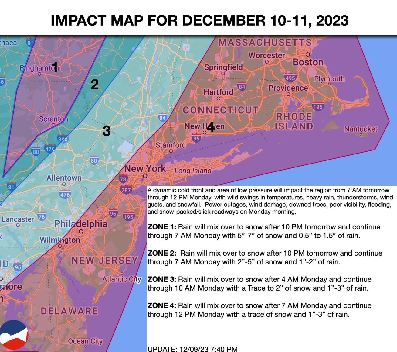
8 AM TOMORROW THROUGH 10 PM TOMORROW:
The cold front will approach with showers developing in the morning, becoming widespread throughout the region. The rain will become heavy as the afternoon continues, while winds will increase at 10 to 20 mph. Temperatures will rise into the 50s to lower 60s in the evening.
10 PM TOMORROW THROUGH 6 AM MONDAY
The cold front will slowly pass through the region with heavy downpours and embedded thunderstorms ahead of the cold front. The thunderstorms will be capable of frequent lightning, visibility below 2 miles, and wind gusts between 40 to 70 mph. Meanwhile, behind the cold front, temperatures will rapidly crash into the 40s and 30s, with rain mixing over to snow. The snow will first accumulate in the highest elevations and mix down towards lower elevations.
6 AM TO 12 PM MONDAY
The area of low pressure along the coast will continue to intensify and lift into New England while precipitation changes from rain to snow towards the coastal plain. Temperatures will rapidly fall through the 50s, 40s, and 30s as the precipitation ends. The snow will be briefly heavy before ending, supporting snow accumulation, mostly on cold surfaces for a short period of time. Locations north and west of the I-95 corridor can expect accumulation over 1″ while locations along and south and east of the I-95 corridor will remain below 1″.


