

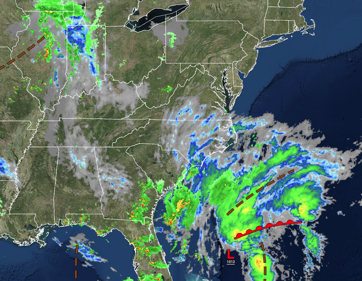
The excellent Fall weather is coming to an end by this weekend as a storm begins to organize to the north of the Bahamas with heavy rain, strong winds, coastal flooding, and power outages expected.
TONIGHT
High pressure will produce scattered clouds to clear skies. Winds will veer from the north to the northeast at 5 to 15 mph. Temperatures will fall into the mid to upper 40s over the interior and lower to mid-50s along the coast for lows.
TOMORROW
High pressure will produce scattered clouds. Winds will be from the northeast at 5 to 15 mph. Temperatures will rise into the lower to mid-70s for highs.
TOMORROW NIGHT
Clouds will increase as a low pressure system approaches from the south. Winds will be from the northeast increasing to 10 to 20 mph along the coast and 5 to 15 mph over the interior. Temperatures will fall into the lower to mid-50s for lows.
SATURDAY
An area of low pressure and a warm front will produce waves of moderate to heavy rainfall along the coast. Scattered showers can be expected over the interior. Urban flooding is a threat along the I-95 corridor. Winds will be from the northeast at 10 to 20 mph over the interior and 15 to 30 mph with gusts over 40 mph at times along the coast. Minor to moderate coastal flooding will be a threat. Power outages will be a threat as well. Temperatures will rise into the lower to mid-60s for highs.
SUNDAY
The low pressure system will slowly pass through the coastal waters with scattered showers throughout the region, heaviest along the coast. Winds will back from the northeast to the north at 10 to 20 mph with gusts up to 30 mph at times. Temperatures will range from the mid to upper 40s over the interior, upper 40s to lower 50s in the suburbs, and lower to mid-50s in urban areas for lows and upper 50s to lower 60s over the interior and along the coast and mid to upper 60s in the Delaware River Valley for highs.
Rainfall amounts from Saturday morning through Sunday evening will range from 1″ to 2″ over the interior and 2″ to 4″ from the Delaware River to the coast.
MONDAY
High pressure will build south from Canada with clearing skies. Winds will be from the north at 10 to 20 mph. Temperatures will range from the upper 40s to lower 50s over the interior and lower to mid-50s along the coast for lows and lower to mid-60s over the interior and upper 60s to lower 70s along the coast for highs.
TUESDAY
High pressure will produce clear skies to scattered clouds. Temperatures will range from the mid to upper 40s over the interior and lower to mid-50s along the coast for lows and upper 60s to mid-70s for highs.
WEDNESDAY
High pressure will produce clear skies to scattered clouds. Temperatures will range from the mid to upper 40s over the interior and lower to mid-50s along the coast for lows and mid to upper 60s over the interior and upper 60s to lower 70s along the coast for highs.
THURSDAY
High pressure will produce clear skies to scattered clouds. Temperatures will range from the mid to upper 40s over the interior and upper 40s to lower 50s along the coast for lows and mid to upper 60s over the interior and along the coast and upper 60s to lower 70s in the Delaware River Valley for highs.
FRIDAY
High pressure will produce clear skies to scattered clouds. Temperatures will range from the mid to upper 40s over the interior and lower to mid-50s along the coast for lows and lower to mid-70s over the interior and coast and mid to upper 70s in the Delaware River Valley for highs.


