


An unsettled weather pattern returns and is expected to linger over the region through this weekend.
TODAY
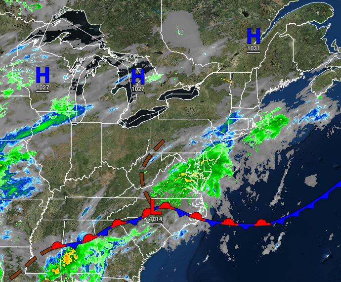
A stationary front will remain to the region’s south with broken cloud cover. Winds will be from the northeast at 5 to 15 mph. Temperatures will rise into the mid to upper 60s for highs.
TONIGHT
Scattered to broken cloud cover will linger over the region. Winds will veer to the east at 5 to 15 mph. Temperatures will fall into the upper 40s to lower 50s over the interior and lower to mid-50s along the coast for lows.
TOMORROW
A warm front will approach with scattered to broken cloud cover through the afternoon. Isolated to widely scattered showers will develop in the evening. Winds will be from the east at 5 to 15 mph. Temperatures will rise into the mid to upper 60s along the coast and upper 60s to lower 70s away from the coast for highs.
TOMORROW NIGHT
Low clouds and fog, along with widely scattered showers, can be expected. Winds will be from the east at 5 to 15 mph. Temperatures will fall into the lower to mid-50s for lows.
THURSDAY
The warm front will stall over the region with broken to overcast skies and widely scattered showers. Temperatures will rise into the mid to upper 60s along the coast and lower to mid-70s away from the coast for highs.
FRIDAY
The warm front will linger over the region with scattered to broken cloud cover with widely scattered showers. A cold front will approach late in the evening with showers and thunderstorms. Temperatures will range from the lower to mid-60s for lows and upper 60s to mid-70s along the coast, mid to upper 70s over the interior, and upper 70s to mid-80s in the Delaware River Valley for highs.
SATURDAY
The cold front will slowly exit with showers and thunderstorms lingering over the region. Temperatures will range from the mid to upper 60s for lows and mid to upper 60s on Long Island, upper 60s to mid-70s along the coast, mid to upper 70s over the interior, and upper 70s to lower 80s in the Delaware River Valley for highs.
SUNDAY
A weak trough will linger over the region with scattered clouds and a few isolated showers. Temperatures will range from the mid to upper 50s over the interior and lower to mid-60s along the coast for lows and upper 60s to lower 70s along the coast, lower to mid-70s over the interior, and mid to upper 70s in the Delaware River Valley for highs.
MEMORIAL DAY MONDAY
High pressure will build into the region with scattered cloud cover and an isolated shower in the morning hours. Temperatures will range from the upper 50s to lower 60s over the interior and lower to mid-60s along the coast for lows and lower to mid-70s along the coast and upper 70s to lower 80s away from the coast for highs.
TUESDAY
High pressure will produce scattered cloud cover. Temperatures will range from the upper 50s to lower 60s for lows and upper 60s to lower 70s on Long Island, mid to upper 70s along the coast, and lower to mid-80s away from the coast for highs.


