


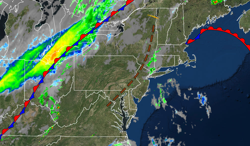
A strong cold front will end the tropical weather conditions and bring about the return of a maritime air mass from the northwestern Atlantic.
TODAY
A trough will pass through the region with a mix of sun and clouds with isolated thunderstorms through this afternoon. A cold front will produce showers and thunderstorms in the evening starting by 6 PM. The thunderstorms will be capable of intense downpours, frequent lightning, hail, and wind gusts over 40 mph. Winds will be from the southwest at 5 to 15 mph. Temperatures rise into the mid-70s to lower 80s on Long Island, lower to mid-80s on the coast, mid to upper 80s over the interior, and mid-80s to lower 90s in the Delaware River Valley for highs. A heat index in the lower to mid-90s can be expected.
TONIGHT
The cold front will exit the region with thunderstorms through midnight, followed by clearing skies by the morning hours. Winds will veer to the northwest at 5 to 15 mph. Temperatures will fall into the lower to mid-40s over the interior and upper 40s to lower 50s along the coast for lows.
TOMORROW
High pressure will produce scattered cloud cover. Winds will veer from the northwest to the north at 5 to 10 mph. Temperatures will rise into the mid to upper 50s over the interior and lower to mid-60s along the coast for highs.
TOMORROW NIGHT
High pressure will shift towards the Gulf of Maine, with scattered clouds expected. Winds will veer from the northeast to the east at 5 to 15 mph. Temperatures will fall into the mid to upper 40s over the interior and lower to mid-50s along the coast for lows.
TUESDAY
High pressure will exit the region with scattered cloud cover. Winds will be from the east at 5 to 15 mph. Temperatures will rise into the lower to mid-60s over the interior, mid to upper 60s along the coast, and upper 60s to lower 70s in the Delaware River Valley for highs.
WEDNESDAY
A wave of low pressure will approach the region with increasing clouds and showers towards evening. Temperatures will range from the lower to mid-50s for lows and lower to mid-60s along the coast and mid to upper 60s away from the coast for highs.
THURSDAY
A warm front will stall over the region with periods of showers. Temperatures will range from the upper 50s to mid-60s for lows and upper 60s to mid-70s along the coast, upper 70s to lower 80s over the interior, and upper 70s to mid-80s in the Delaware River Valley for highs.
FRIDAY
An area of low pressure will move through the region with periods of showers, heavy at times. Temperatures will range from the lower to mid-60s over the interior and mid to upper 60s along the coast for lows and upper 60s to mid-70s along the coast and over the interior and mid to upper 70s in the Delaware River Valley for highs.
SATURDAY AND SUNDAY
High pressure will build into the region, with clear skies to scattered cloud cover. Temperatures on Saturday will range from the upper 40s to mid-50s over the interior and upper 50s to lower 60s for lows and lower to mid-70s over the interior, lower to mid-70s along the coast, and upper 70s to lower 80s in the Delaware River Valley for highs. Temperatures on Sunday will range from the upper 40s to lower 50s over the interior and lower to mid-50s along the coast for lows and lower to mid-70s along the coast, mid to upper 70s over the interior and upper 70s to lower 80s in the Delaware River Valley for highs.


